
Send the property postcode with any floor plans, EPC or construction notes already available. We will confirm the evidence route, travel allowance and price before the diary is booked.
Local housing
Heat loss survey Wakefield: local homes and building types
Wakefield city sits within a district that also includes Ossett, Horbury, Castleford, Normanton, Pontefract and former mining communities to the south and east. The report has to follow the property in front of us rather than treat every WF postcode as the same building type.
Housing mix
Semi-detached homes form the largest group
Census 2021 recorded 44.6% of Wakefield households in semi-detached homes. Detached properties accounted for 22.3%, terraces 22.0% and purpose-built flats 9.1%.
That mix changes exposed wall area, party-wall treatment, roof form and the number of elevations that need to be measured.
Property age
Almost a third of the stock predates 1945
Wakefield Council's 2025 housing assessment records 31.5% of dwellings as built before 1945, 40.0% between 1945 and 1982 and 28.4% since 1983. Age is a starting point, not a substitute for checking the actual fabric and later alterations.
Local pattern
The housing mix changes by neighbourhood
Wakefield Central includes compact terraces, flats and older streets around Agbrigg, Kirkgate and Westgate. Ossett and Horbury bring a different mix of established terraces and semis; City Fields adds newer housing, while Castleford, Pontefract and the Five Towns extend the district well beyond the city boundary.
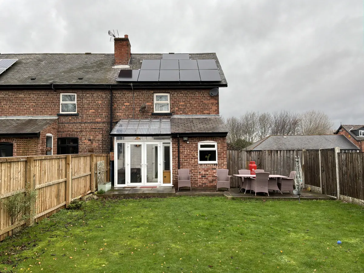
Anonymised rear elevation from a completed Vertex survey in Wakefield district. Customer name and exact address withheld.
Wakefield case study
A pre-1900 end terrace with solid-brick walls
This three-bedroom property in Wakefield district had nine surveyed rooms, nine windows and two floors. The main house was recorded as pre-1900 solid-brick construction.
A later extension, four floor-plan captures and the existing LPG heating arrangement were documented separately. The electrical record also showed no spare consumer-unit ways, giving the installer a constraint to review alongside the room-by-room result.
Evidence that separates original fabric from later work
Older Wakefield properties can combine solid walls, altered openings, replacement glazing and extensions from different periods. The report keeps those inputs visible so the designer can trace the room result back to the survey evidence.
Room data
Measurements tied to each room
Internal dimensions, ceiling heights and exposed surfaces
Window and door sizes, glazing type and orientation
Existing emitters and relevant ventilation inputs
Fabric
Fabric recorded by element
The wall, roof, floor and glazing entries remain visible alongside the calculation. On the featured end terrace, the original solid-brick house and later extension were recorded separately instead of being assigned one blanket age assumption.
Where insulation cannot be seen or supported by documents, the uncertainty is left visible for the design reviewer.
Handover
Constraints carried into handover
Room-by-room figures with the whole-property result
Construction entries and extension notes beside the measured data
Supporting photos and floor plans retained with the job in the Vertex Portal
Electrical and access constraints available to the installer team
Coverage
Survey coverage and travel around Wakefield
Wakefield district covers the city, the Five Towns and settlements from Ossett and Horbury to South Elmsall. Travel is planned from the actual postcode so a central WF1 appointment is not treated like a visit to Pontefract, Castleford or the district's south-eastern edge.
Main routes
Motorway access does not make every route the same
Wakefield sits where the M1 and M62 corridors meet. The A638 approaches from Doncaster and serves the east of the city, while the A650, A61 and A639 connect northern Wakefield and routes toward Leeds.
Local access
Town streets and rural edges need different planning
Older terraces around Agbrigg, Kirkgate and parts of Castleford can have tighter kerb space and rear access. Rural-edge properties near Heath, Woolley and villages west of the A1 may use narrower local roads, so parking and access notes are checked before the visit.
Outer areas
Outlying postcodes are treated as distinct routes
Ossett and Horbury, Castleford and Normanton, Pontefract and Knottingley, and South Elmsall are planned as distinct routes rather than city-centre calls. Vertex also covers neighbouring Leeds, Rotherham, Sheffield, Doncaster and installer projects throughout the UK.
Each room carries its dimensions, exposed surfaces, glazing, fabric entries, ventilation inputs and existing emitter information. The resulting room figures sit with the property assumptions and supporting site record for installer review.
Desktop route
Can the calculation be completed from drawings?
A desktop calculation is available when the drawings identify every heated space and the construction information is credible. A measured visit is normally the better route for older terraces, undocumented extensions or properties where insulation evidence is incomplete.
Area
Which Wakefield areas does Vertex cover?
Vertex covers Wakefield city and district, surrounding West Yorkshire postcodes and installer projects throughout the UK. Timing and travel are confirmed from the job postcode before booking.
Still checking scope? See the full FAQ or contact Vertex with the postcode and available property information.
Pricing
Pricing and booking
The final quote depends on the evidence available, whether a measured visit is required and the property scope.
Heat loss onlyFrom £150
For a standalone calculation where the drawings, measurements or survey evidence support the route.
ASHP survey + heat lossFrom £350
For installer teams that need fresh site evidence and the room-by-room calculation together.
Scope, travel and timing are confirmed from the postcode and available evidence before the diary is committed. For the full service route, see the UK heat loss survey page.